270 results
-


Oxford. Bodleian Library, Filmstrip Roll 271.1, frame 6

- Collection
- Digital Bodleian (Oxford University)
- Library
- Oxford. Bodleian Library
- Date
- 1797
- Language
- English
-
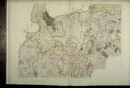
Largely blank extract from the north-east of the map
-

Oxford. Bodleian Library, MS. Wood C. 9
- Collection
- Digital Bodleian (Oxford University)
- Library
- Oxford. Bodleian Library
- Date
- 1588
- Language
- English
-
Scottish monarchs: a selection of portraits, from Malcolm Canmore to James VI.
-

Oxford. Bodleian Library, BOD: Gough Maps 86
- Collection
- Digital Bodleian (Oxford University)
- Library
- Oxford. Bodleian Library
- Date
- 1693
- Language
- English
-
Cartouches from the main chart and inset of the River Thames
-

Oxford. Bodleian Library, Filmstrip Roll 190J, frame 3
- Collection
- Digital Bodleian (Oxford University)
- Library
- Oxford. Bodleian Library
- Date
- 1607
- Language
- English
-
From 'Sussexiae sive Southsex olim pars Regnorum'. Scale c. 1: 270,000.
-

Oxford. Bodleian Library, MS. Top. Glouc. a. 3 (R)
- Collection
- Digital Bodleian (Oxford University)
- Library
- Oxford. Bodleian Library
- Date
- c. 1520-1530
- Language
- English
-
of the development of the 'drop line' pedigree: that is, one which shows the children on drop lines from
-
Oxford. Bodleian Library, Filmstrip Roll 271.1, frame 14
- Collection
- Digital Bodleian (Oxford University)
- Library
- Oxford. Bodleian Library
- Date
- 1797
- Language
- English
-
The new road from Shotover to St Clement's is the present London Road.
-

Oxford. Bodleian Library, Filmstrip Roll 235.5, frame 21
- Collection
- Digital Bodleian (Oxford University)
- Library
- Oxford. Bodleian Library
- Date
- 1660
- Language
- English
-
Decorated scale and compass-rose in close-up from John Burston's chart. Mounted on hinged boards.
-

Oxford. Bodleian Library, Filmstrip Roll 190J, frame 6
- Collection
- Digital Bodleian (Oxford University)
- Library
- Oxford. Bodleian Library
- Date
- 1724
- Language
- English
-
From Richard Budgen, An Actual Survey of Sussex, engraved by I. Senex. Scale 1: 85,000
-


Cambridge. Corpus Christi College, Parker Library MS 100
- Collection
- Parker Library On the Web (Cambridge)
- Library
- UK, Cambridge, Corpus Christi College, Parker Library
- Date
- 1500 - 1599
- Language
- lat, eng
-
particular interest is the transcript of Asser's De rebus gestis Ælfredi regis which was transcribed from
-

Oxford. Bodleian Library, Filmstrip Roll 235.5, frame 12
- Collection
- Digital Bodleian (Oxford University)
- Library
- Oxford. Bodleian Library
- Date
- 1741
- Language
- English
-
West coast of India from Surat to Cape Comorin: lower half of the map
-

Oxford. Bodleian Library, Filmstrip Roll 235.5, frame 14
- Collection
- Digital Bodleian (Oxford University)
- Library
- Oxford. Bodleian Library
- Date
- 1697
- Language
- English
-
Portolan chart; Note, a few inches has been cut from the top, removing Bangkok
-

Oxford. Bodleian Library, Filmstrip Roll 235.5, frame 11
- Collection
- Digital Bodleian (Oxford University)
- Library
- Oxford. Bodleian Library
- Date
- 1741
- Language
- English
-
West coast of India from Surat to Cape Comorin: top half of the map
-

Oxford. Bodleian Library, Filmstrip Roll 190J, frame 1
- Collection
- Digital Bodleian (Oxford University)
- Library
- Oxford. Bodleian Library
- Date
- 1575
- Language
- English
-
From Atlas of the counties of England and Wales - scale c.1: 250,000
-

Oxford. Bodleian Library, Filmstrip Roll 235.5, frame 28
- Collection
- Digital Bodleian (Oxford University)
- Library
- Oxford. Bodleian Library
- Date
- 1697
- Language
- English
-
Decorated scale in close-up from Augustine Fitzhugh's portolan chart, MS. D1 (185) [4]
-

Oxford. Bodleian Library, BOD: MAP RES 75 / Gough Maps 90
- Collection
- Digital Bodleian (Oxford University)
- Library
- Oxford. Bodleian Library
- Date
- 1725
- Language
- English
-
Saxton's Oxfordshire, Buckinghamshire and Berkshire amended by Lea from The Shires of England and Wales
-

Oxford. Bodleian Library, Filmstrip Roll 235.5, frame 27
- Collection
- Digital Bodleian (Oxford University)
- Library
- Oxford. Bodleian Library
- Date
- 1684
- Language
- English
-
Decorated scale and compass-rose in close-up from Joel Gascoyne's chart, MS. Don. a. 5
-

Oxford. Bodleian Library, Filmstrip Roll 235.5, frame 23
- Collection
- Digital Bodleian (Oxford University)
- Library
- Oxford. Bodleian Library
- Date
- 1665
- Language
- English
-
Decorated scale and compass-rose in close-up from Nicholas Comberford's portolan chart, MS.
-

Oxford. Bodleian Library, BOD: Gough Sussex 1 (3)
- Collection
- Digital Bodleian (Oxford University)
- Library
- Oxford. Bodleian Library
- Date
- 1793
- Language
- English
-
From Arthur Young, General view of the agriculture of the county of Sussex. Scale c. 1: 300,000
-

Oxford. Bodleian Library, Filmstrip Roll 243.9, frame 2
- Collection
- Digital Bodleian (Oxford University)
- Library
- Oxford. Bodleian Library
- Date
- 1645?
- Language
- English, Latin
-
Map of Oxfordshire with hills, woods and parks; and arms of the Oxford colleges, from Joan Blaeu, Novus
-

Oxford. Bodleian Library, (E) C17:70 Oxford (40)
- Collection
- Digital Bodleian (Oxford University)
- Library
- Oxford. Bodleian Library
- Date
- 1694-99
- Language
- English
-
Map of Port Meadow, two cartouches flanking 'The Prospect of Oxford from the North'; inset of St. martin's
- Please select items from search results or item pages.
