- Remove all filters
- language : English
- query : CHECK MAGICSHROOMY.COM kup grzyby halucynogenne online in fact the actual reasons
603 results
-


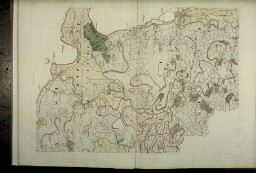
Oxford. Bodleian Library, Filmstrip Roll 271.1, frame 6

- Collection
- Digital Bodleian (Oxford University)
- Library
- Oxford. Bodleian Library
- Date
- 1797
- Language
- English
- Largely blank extract from the north-east of the map
-

Oxford. Bodleian Library, Filmstrip Roll 271.1, frame 18
- Collection
- Digital Bodleian (Oxford University)
- Library
- Oxford. Bodleian Library
- Date
- 1797
- Language
- English
- Wallingford town shown outside the county boundary
-

Oxford. Bodleian Library, RSL: Per. 1996 d. 879
- Collection
- Digital Bodleian (Oxford University)
- Library
- Oxford. Bodleian Library
- Date
- 1788
- Language
- English
- An article discussing the theory of the earth, including an investigation of its laws, using evidence
-

Oxford. Bodleian Library, MS. Ashmole 1120
- Collection
- Digital Bodleian (Oxford University)
- Library
- Oxford. Bodleian Library
- Date
- 1563
- Language
- English
- Inscription at the top: 'A copie of an owldde Roule in ye kepinge of Mr.
-


Oxford. Christ Church, Library, Mus 986
- Collection
- Digital Bodleian (Oxford University)
- Library
- Oxford. Christ Church, Library
- Date
- 1581–1588
- Language
- Latin, English
- This set is one of the most important surviving music manuscripts from Elizabethan England, and a major
-

Oxford. Christ Church, Library, Mus 985
- Collection
- Digital Bodleian (Oxford University)
- Library
- Oxford. Christ Church, Library
- Date
- 1581–1588
- Language
- Latin, English
- This set is one of the most important surviving music manuscripts from Elizabethan England, and a major
-

Oxford. Bodleian Library, S. Seld. d.5
- Collection
- Digital Bodleian (Oxford University)
- Library
- Oxford. Bodleian Library
- Date
- [after 12 Aug. 1481]
- Language
- English
- Image Du Monde (Myrrour of the worlde)
-

Oxford. Bodleian Library, Filmstrip Roll 271.1, frame 13
- Collection
- Digital Bodleian (Oxford University)
- Library
- Oxford. Bodleian Library
- Date
- 1797
- Language
- English
- The scale of the Oxford city map is three chains to one inch, or 1: 2,376.
-

Oxford. Bodleian Library, BOD: Gough Maps 100
- Collection
- Digital Bodleian (Oxford University)
- Library
- Oxford. Bodleian Library
- Date
- 1675
- Language
- English
- Road map from John Ogilby, Book of Roads, The Principal Road-ways of His Majesty's Kingdom of England
-

Oxford. Christ Church, Library, Mus 987
- Collection
- Digital Bodleian (Oxford University)
- Library
- Oxford. Christ Church, Library
- Date
- 1581–1588
- Language
- Latin, English
- This set is one of the most important surviving music manuscripts from Elizabethan England, and a major
-

Paris. Bibliothèque nationale de France, Département des manuscrits, Anglais 169-174
- Collection
- Gallica (Bibliothèque nationale de France)
- Library
- Paris. Bibliothèque nationale de France, Département des manuscrits
- Date
- XVIe-XIXe siècle
- Language
- anglais
- Willima Udall, The Historie of the life and death of Mary Stuart, queene of Scotland, illustré de portraits
-

Oxford. Bodleian Library, Filmstrip Roll 235.5, frame 11
- Collection
- Digital Bodleian (Oxford University)
- Library
- Oxford. Bodleian Library
- Date
- 1741
- Language
- English
- West coast of India from Surat to Cape Comorin: top half of the map
-

Oxford. Bodleian Library, Gough Maps Oxfordshire 12
- Collection
- Digital Bodleian (Oxford University)
- Library
- Oxford. Bodleian Library
- Date
- 1751
- Language
- English
- Includes a key to colleges and halls and a table of the number of houses and inhabitants in each street
-

Oxford. Bodleian Library, Filmstrip Roll 271.1, frame 5
- Collection
- Digital Bodleian (Oxford University)
- Library
- Oxford. Bodleian Library
- Date
- 1797
- Language
- English
- A map of the County of Oxford
-

Oxford. Bodleian Library, Filmstrip Roll 271.1, frame 3
- Collection
- Digital Bodleian (Oxford University)
- Library
- Oxford. Bodleian Library
- Date
- 1797
- Language
- English
- The index of 16 sheets shows the whole map of Oxfordshire with inset map of the city of Oxford
-

Oxford. Bodleian Library, Filmstrip Roll 271.1, frame 17
- Collection
- Digital Bodleian (Oxford University)
- Library
- Oxford. Bodleian Library
- Date
- 1797
- Language
- English
- Close-up of inset map of the city of Oxford with High Street, colleges and the Botanic Garden; and edging
-

Oxford. Bodleian Library, Filmstrip Roll 235.5, frame 19
- Collection
- Digital Bodleian (Oxford University)
- Library
- Oxford. Bodleian Library
- Date
- 1701
- Language
- English
- [The Java Sea by John Thornton, 1701]
-
Oxford. Bodleian Library, Filmstrip Roll 271.1, frame 14
- Collection
- Digital Bodleian (Oxford University)
- Library
- Oxford. Bodleian Library
- Date
- 1797
- Language
- English
- The new road from Shotover to St Clement's is the present London Road.
-

Oxford. Bodleian Library, Filmstrip Roll 235.5, frame 2
- Collection
- Digital Bodleian (Oxford University)
- Library
- Oxford. Bodleian Library
- Date
- 1665
- Language
- English
- The passages from Ireland, Bristol, Southampton, London, and the east coast to Iceland, Bergen, the White
-

Oxford. Bodleian Library, Filmstrip Roll 271.1, frame 19
- Collection
- Digital Bodleian (Oxford University)
- Library
- Oxford. Bodleian Library
- Date
- 1797
- Language
- English
- River Thames forms the southern boundary of Binfield Hundred with almost all the land enclosed.